An image processing system that automatically detects and maps potholes on city roads using vehicle mounted cameras and artificial intelligence, and converts them into work orders.
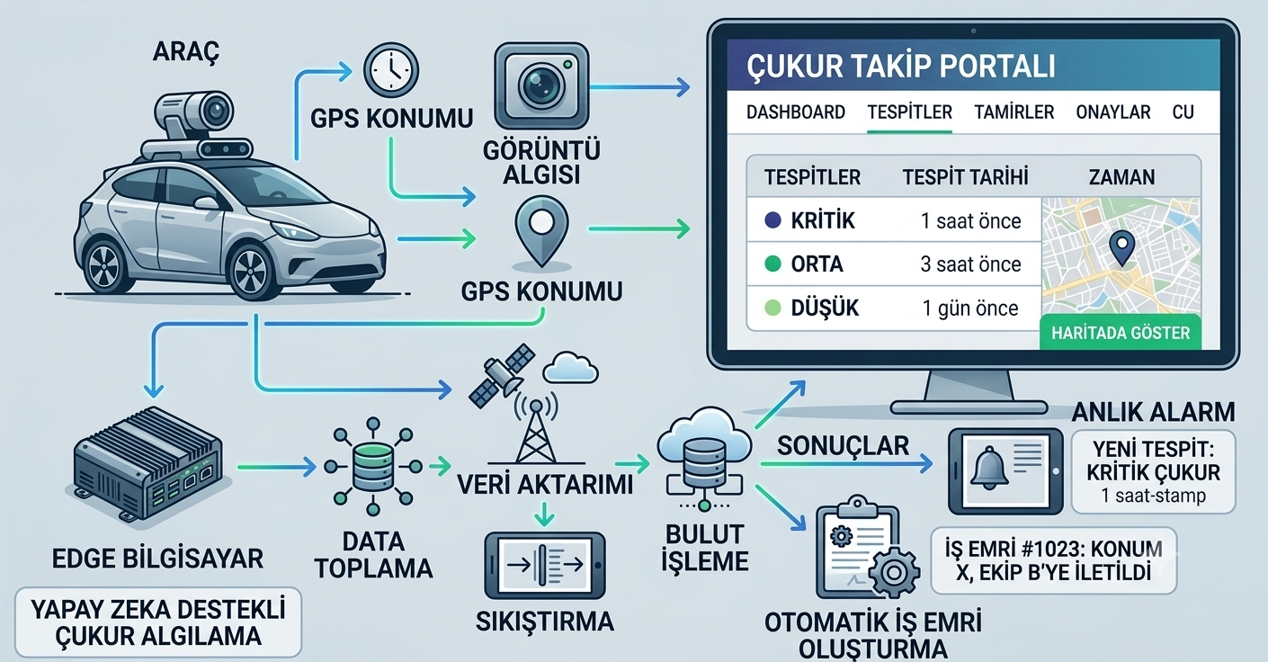
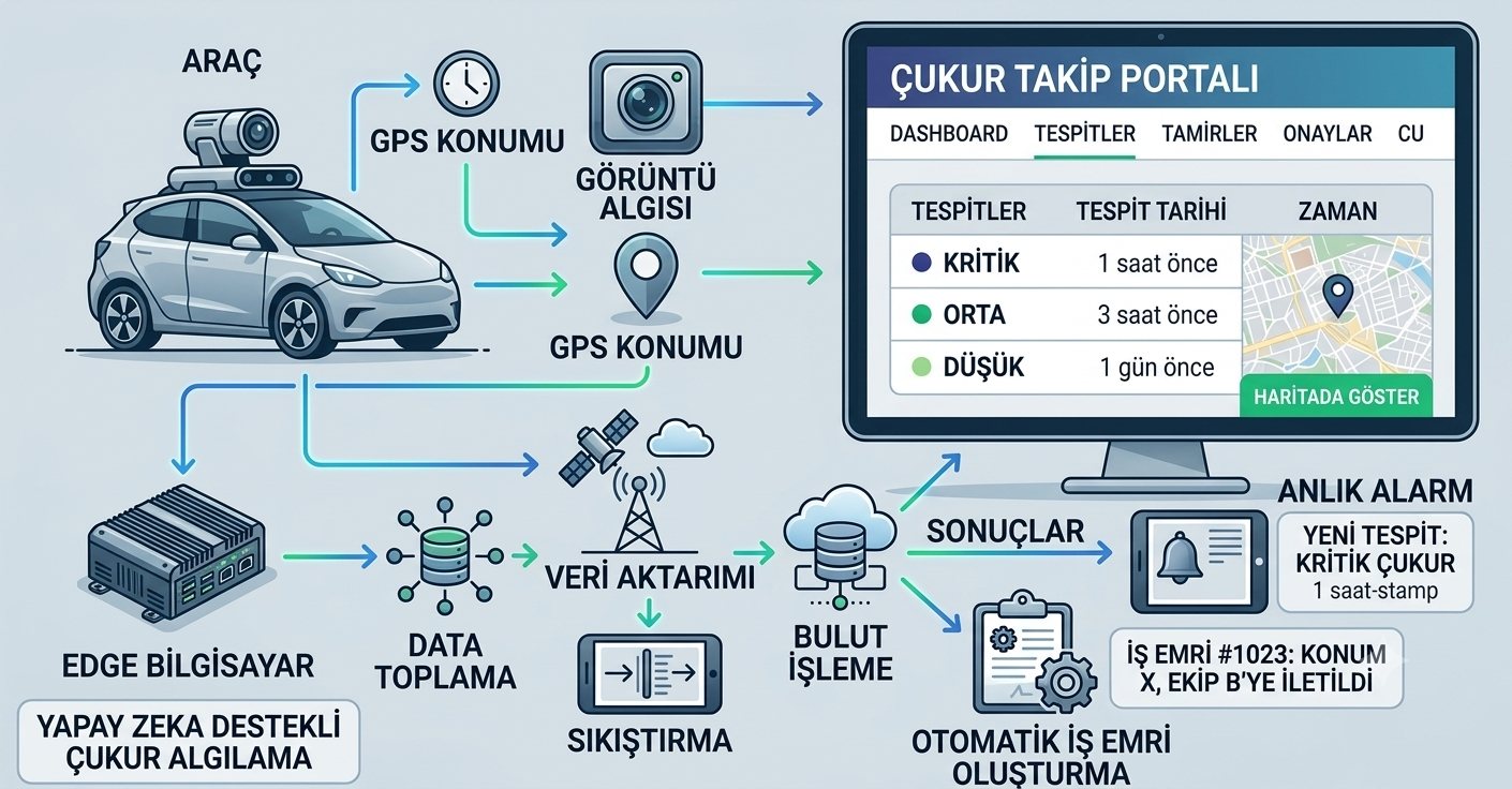
The Smart Pothole Detection System is an end to end solution that automatically detects, locates, and connects potholes on city and intercity roads to the repair process using a vehicle mounted camera and AI powered image processing. Working independently of vehicle speed and requiring no driver intervention, the system continuously scans the road surface and transmits the collected image, location, and time data to a central web portal.
In the traditional method, potholes are only noticed after a citizen complaint arrives. With this system, problems are detected and prioritized automatically before they grow larger.
Key Features
- High resolution camera: continuously scans the road surface, effective detection at all hours thanks to night vision sensors
- Precise GPS module: adds location data and a timestamp to every detection
- Onboard AI processing unit: collects data in real time, analyzes it, filters out unnecessary footage
- Smart data compression: only the image regions containing a pothole detection are stored in high quality, reducing data size and transfer cost
- Secure transmission: the connection to the portal is encrypted; if the internet connection drops, data is temporarily stored on the vehicle and automatically synced once the connection returns
- Risk level classification: critical, high, medium, and low priority levels
- Google Maps integration for location verification and map display
- Work order automation: automatic task assignment to responsible staff and tracking through the mobile app
How It Works
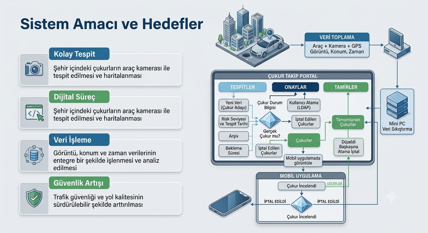
Every detected pothole candidate first lands in the detection list on the web portal. An authorized user reviews the high resolution image, verifies the location on the map, and reassesses the pothole's urgency level (response targets are 24 hours for critical, 3 days for high, 1 week for medium priority). Approved detections are assigned as a work order to the field team; the team views the task through the mobile app, uploads a photo after the repair, and updates the status. This keeps the entire process, from detection to repair, digitally recorded and reportable.
Benefits
- Detection to repair time is reduced by an average of sixty percent compared to manual processes
- The automatic detection system reaches a ninety five percent accuracy rate
- Small potholes are repaired before growing, avoiding more costly repairs later
- Traffic safety improves, and vehicle and driver damage decreases
- All detection and repair data is kept on record digitally, making reporting and strategic planning easier